The Generic Quantitative Risk Assessment of existing soil contamination at the Lower Botanic Gardens, Belfast, was designed to identify areas of soil contamination, assess risk potential and pollutant linkages, and highlight areas on the Lower Botanic Gardens site that contains existing soil contamination that may require further investigation or remediation in accordance with UK government guidance (Environment Agency, 2021). This was achieved through a review of the Preliminary Risk Assessment (Newell, 2022) and a tailored exploratory site investigation and laboratory analysis undertaken during October-November 2022.
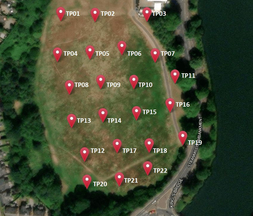
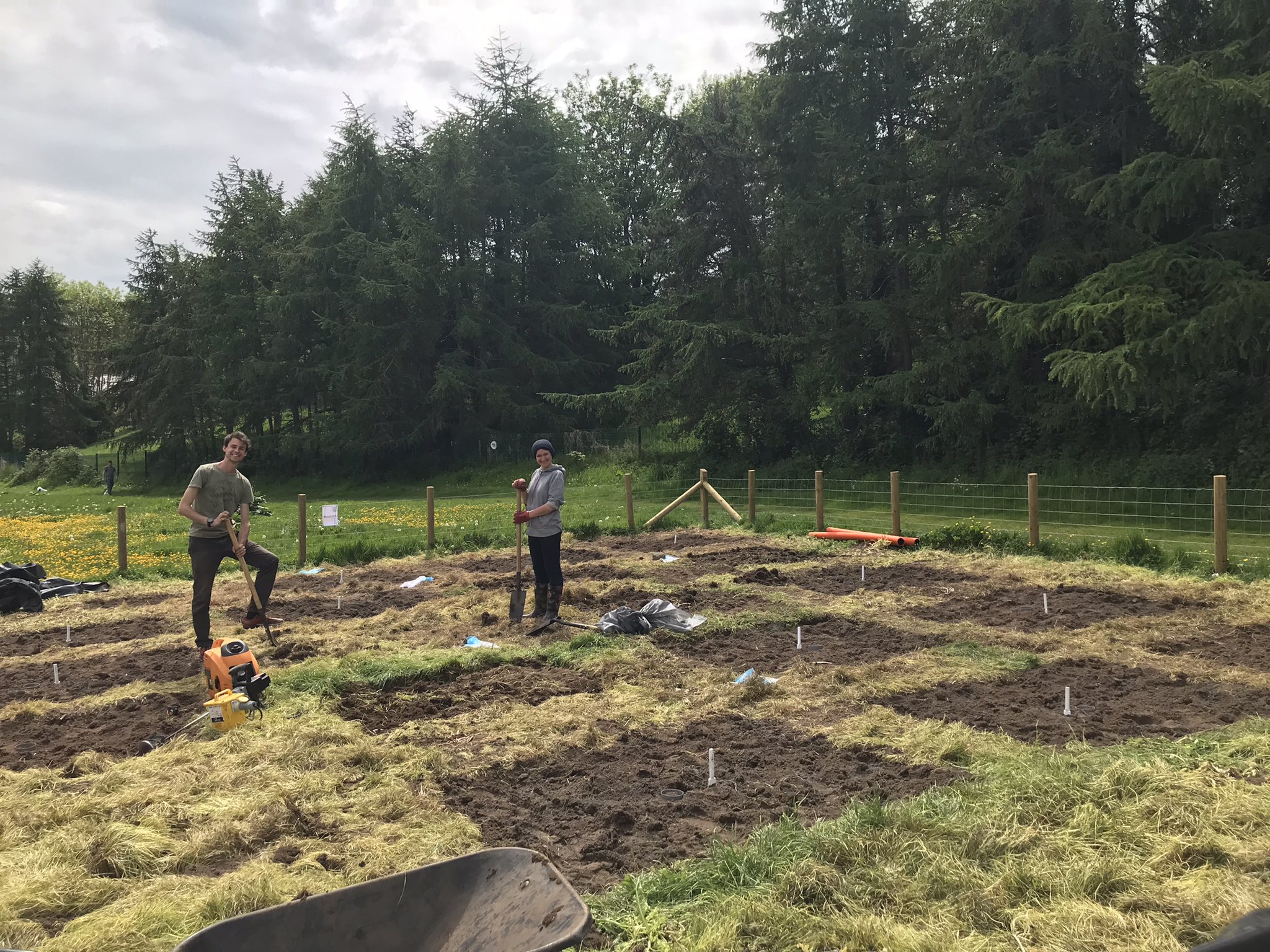
The exploratory site investigation was designed by Armstrong (2022) and comprised a non-targeted, intrusive/disturbed spot sampling design. Here, 22 sampling points were established on an offset herringbone grid across the site (Figure 1). Trial pits were excavated to 0.5m using a micro-digger, and samples were taken at 0.3m (6 samples) and 0.5m (22 samples) and sent to a UKAS-accredited laboratory for analysis. A second sampling exercise was undertaken in November to replace three samples that had been lost in transit to the laboratory.
The site investigation confirmed a ~30cm layer of clean topsoil under the turfed surface and a subsequent layer of heterogenous industrial infill, as reported in Kirk McClure Morton (2003). The results from the site investigation confirmed the presence of metal and organic contamination stemming from the historical industrial fill and thus confirmed the potential for human health hazards associated with inhalation and ingestion of site substrates. These observations were then used to refine the original conceptual site model developed in the Preliminary Risk Assessment (Newell, 2022). After confirming potential risks, each proposed feature on the Lower Botanic Gardens development was assessed according to user interaction with contaminated soils. Open spaces covered with hardstanding/imported materials/extensive vegetation were deemed to have little risk to site users due to the physical barrier to soils. Alternately, exposed soil and allotment-type spaces, including play areas and areas for cultivating plants, present an increased risk of soil contact and may require remediation measures. A remediation strategy was designed for the first proposed site feature: the Research Gardens. Prior to use, this feature should have appropriate signage and fencing to limit public use. Further investigations may be required when developing other areas of the site.

| Trial pit no. | Depth / m | IGR.X. | IGR.Y | Latitude | Longitude |
| TP01 | 0.3, 0.5 | 333846 | 372047 | 54.57911 | -5.93048 |
| TP02 | 0.5 | 333878 | 372047 | 54.5791 | -5.92999 |
| TP03 | 0.5 | 333926 | 372049 | 54.57911 | -5.92925 |
| TP04 | 0.5 | 333844 | 372009 | 54.57877 | -5.93053 |
| TP05 | 0.5 | 333874 | 372012 | 54.57879 | -5.93007 |
| TP06 | 0.5 | 333904 | 372017 | 54.57883 | -5.9296 |
| TP07 | 0.3, 0.5 | 333935 | 372011 | 54.57876 | -5.92912 |
| TP08 | 0.5 | 333856 | 371979 | 54.5785 | -5.93036 |
| TP09 | 0.3 | 333885 | 371985 | 54.57854 | -5.92991 |
| TP10 | 0.3, 0.5 | 333916 | 371986 | 54.57855 | -5.92943 |
| TP11 | 0.5 | 333954 | 371992 | 54.57859 | -5.92884 |
| TP12 | 0.3, 0.5 | 333872 | 371917 | 54.57794 | -5.93014 |
| TP13 | 0.5 | 333859 | 371948 | 54.57822 | -5.93033 |
| TP14 | 0.5 | 333888 | 371954 | 54.57827 | -5.92988 |
| TP15 | 0.5 | 333919 | 371957 | 54.57828 | -5.9294 |
| TP16 | 0.3, 0.5 | 333950 | 371965 | 54.57835 | -5.92891 |
| TP17 | 0.5 | 333902 | 371926 | 54.57801 | -5.92967 |
| TP18 | 0.5 | 333932 | 371927 | 54.57801 | -5.92921 |
| TP19 | 0.5 | 333963 | 371935 | 54.57807 | -5.92873 |
| TP20 | 0.3, 0.5 | 333875 | 371892 | 54.57771 | -5.93011 |
| TP21 | 0.5 | 333905 | 371895 | 54.57773 | -5.92964 |
| TP22 | 0.5 | 333931 | 371906 | 54.57782 | -5.92923 |
References
Armstrong, E. 2022. MEng student paper. Assessing the Risks posed by Land Contamination at Lower Botanic Gardens, Belfast. Queen’s University Belfast. Unpublished. (Accessed 21 May 2022)
Environment Agency (2021) Guidance: LCRM: Stage 1 risk assessment. Available at: https://www.gov.uk/government/publications/land-contamination-risk-management-lcrm/lcrm-stage-1- risk-assessment#tier-1-preliminary-risk-assessment (Accessed 22 November 2021).
Kirk McClure Morton (2003) Contaminated Land Survey Final Report. Queen’s University Belfast. Ref: 5460.09/Reports.
Nathanail, C. P., McCaffrey, C., Gillett, A. G., Ogden, R., & Nathanail, J. (2015). The LQM/CIEH S4ULs for human health risk assessment. Land Quality Press.
Newell (2022) Preliminary Risk Assessment Lower Botanic Gardens, Belfast [Internal report].
Newell (2023) Phase 2 Site Investigation Report: Exploratory investigation including Generic Quantitative Risk Assessment – Lower Botanic Gardens, Belfast [Internal report]

